Log in
All resources
Create a design
11,660 Free Images of Old Map
maps made in the 17th century
gerard valck
atlantis magni tomus tertius (biblioteca comunale di trento)
maps by pieter schenk (i)
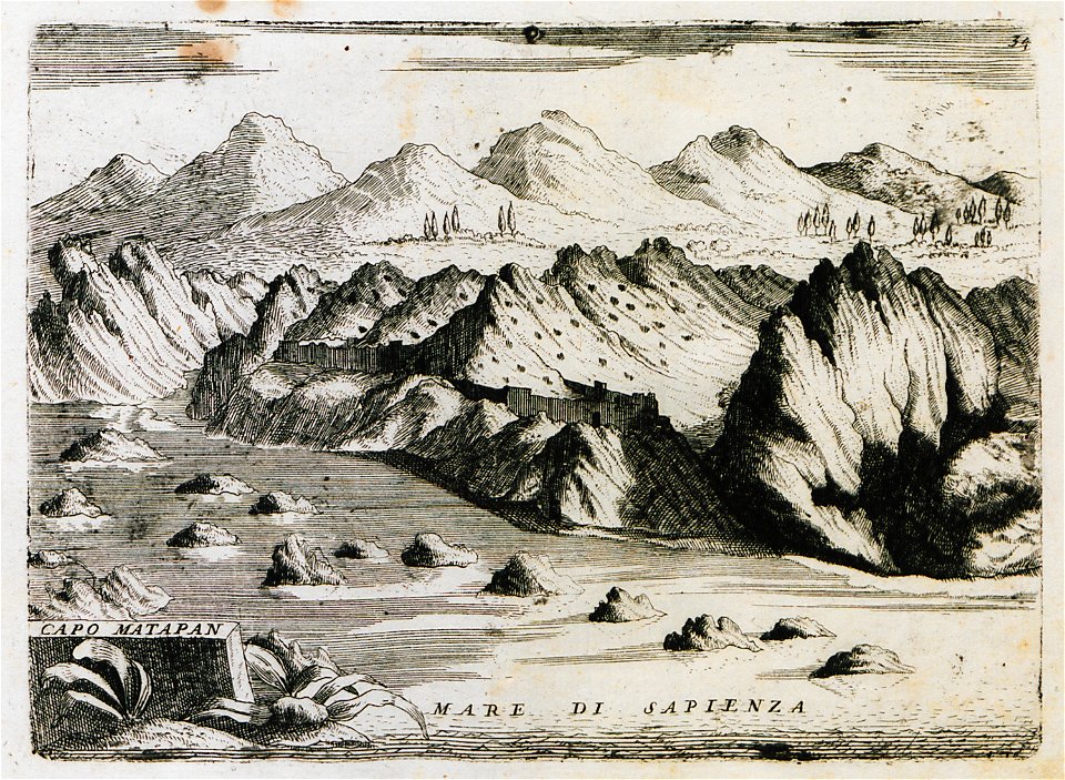
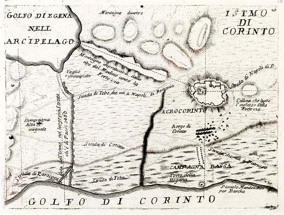
old maps of the peloponnese
maps
atlantis magni tomus secundus (biblioteca comunale di trento)
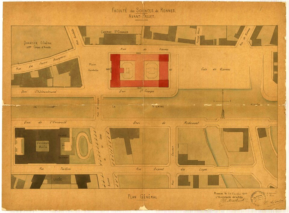
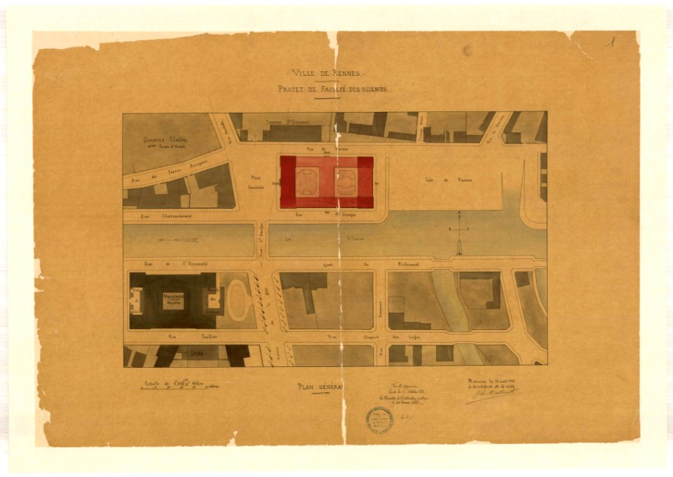
old maps of rennes
geographical illustrations by coronelli
maps made in the 18th century
images from bristol past and present (1882)
bristol
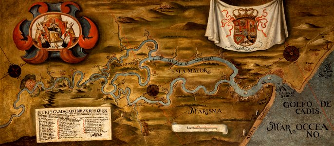
guadalquivir
1760 maps
hawaii in the 1810s
louis choris
collections of staatsbibliothek bamberg
franconian switzerland
maps made in the 17th century
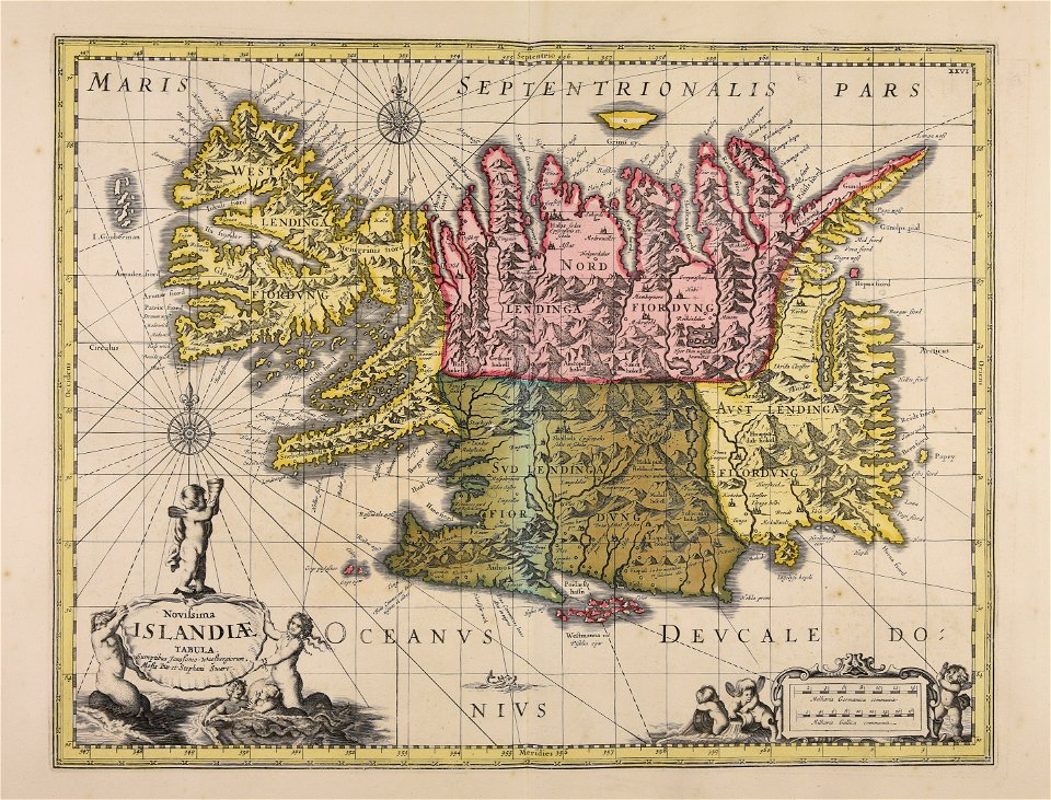
old maps of iceland
maps made in the 18th century
johann baptist homann
maps made in the 18th century
johann baptist homann
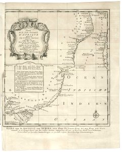
old maps of the dutch east india company - africa
1747)
frédéric-auguste laguillermie
molière
1780 maps of finland
1780 maps of norway
earth
maps
atlantis magni tomus tertius (biblioteca comunale di trento)
maps made in the 17th century
1790s drawings
palace park
files from the bodleian libraries
old maps of africa
vatican gallery of maps
old maps of italy
medieval
maps
medieval
maps
17th-century engravings
frans post
maps made in the 17th century
gerard valck
maps in the library of congress
old maps of massachusetts
maps in the library of congress
old maps of massachusetts
maps in the library of congress
old maps of massachusetts
maps made in the 17th century
gerard valck
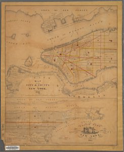
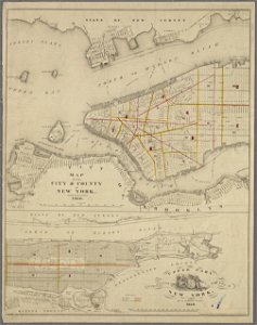
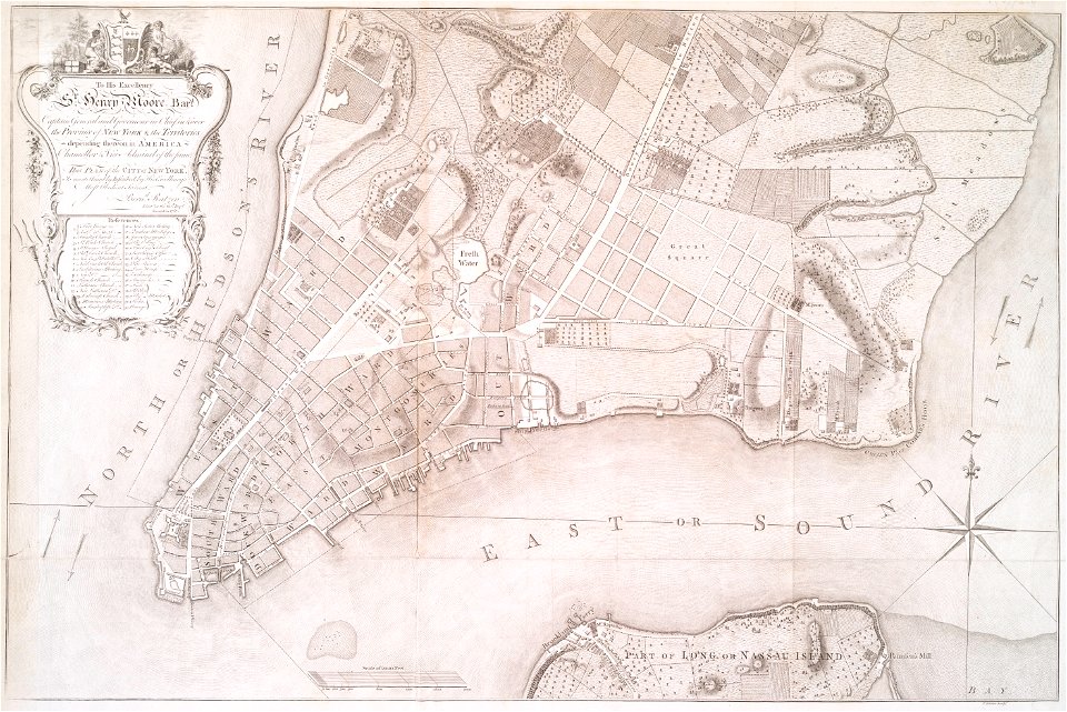
manual of the corporation of the city of new york (1861)
new york city
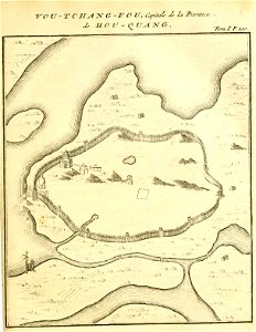
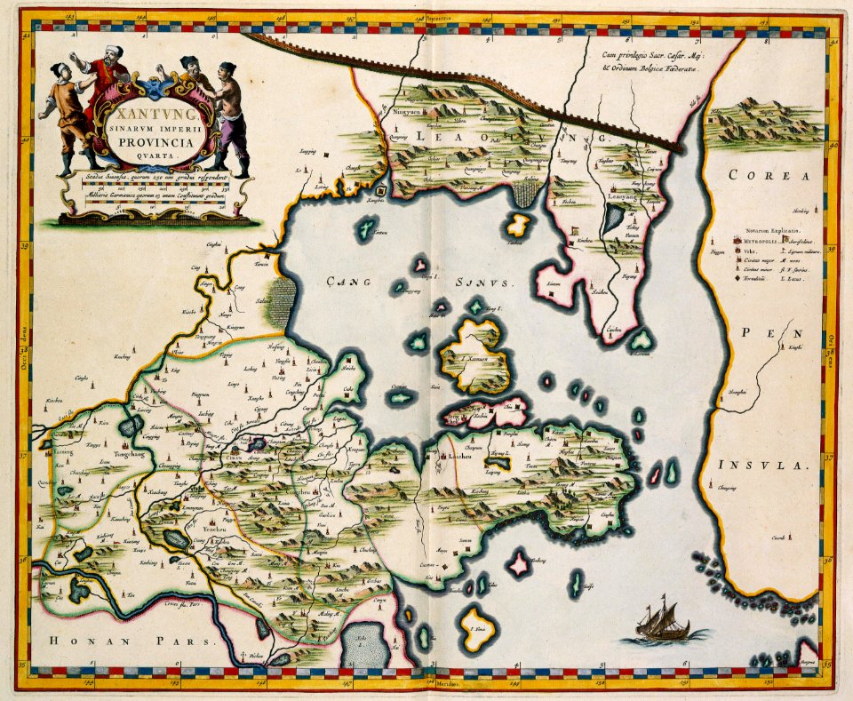
french-language maps of china
old maps of wuhan
maps made in the 17th century
gerard valck
pirate
maps
1780 maps of armenia
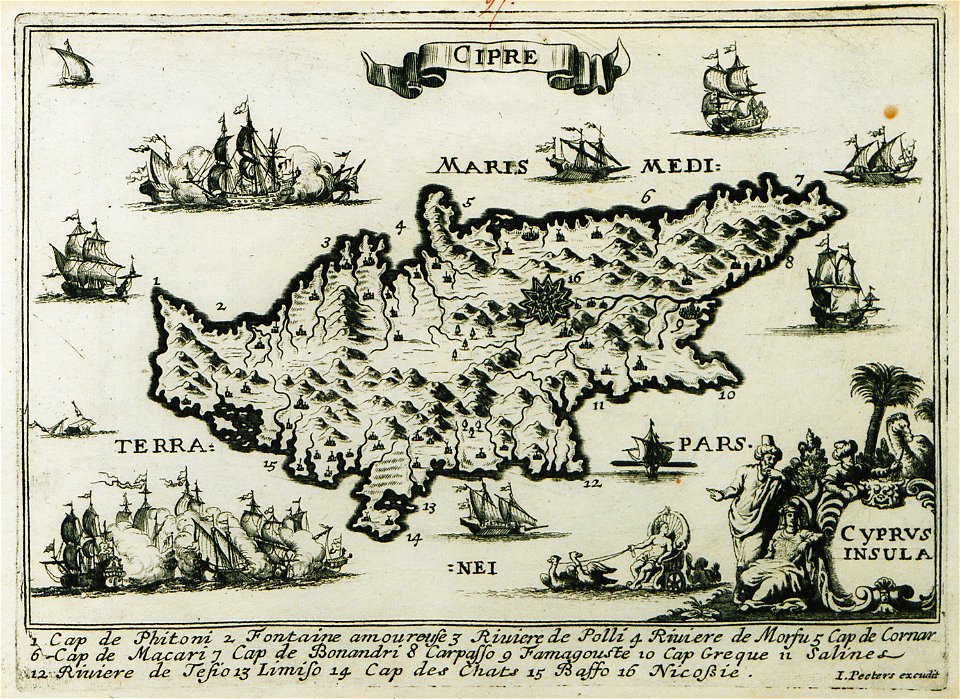
1780 maps of cyprus
maps from the mechanical curator collection
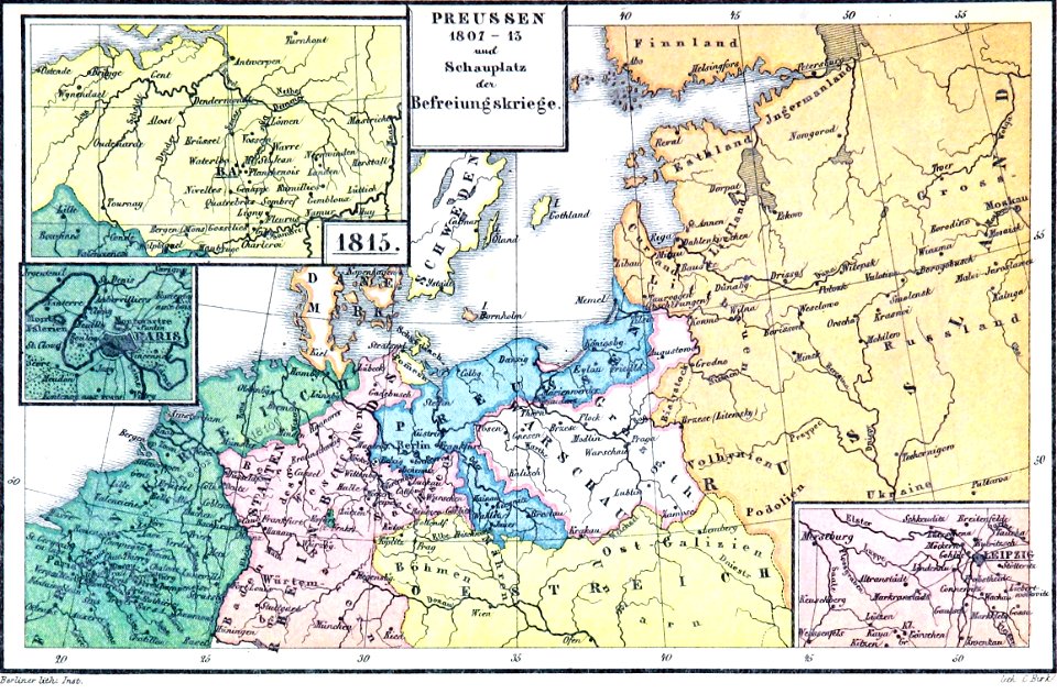
old maps of prussia
maps from the mechanical curator collection
old maps of prussia
maps
sea
palais liechtenstein (fürstengasse)
vienna
maps made in the 17th century
gerard valck
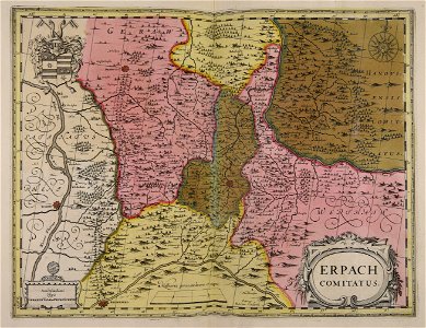
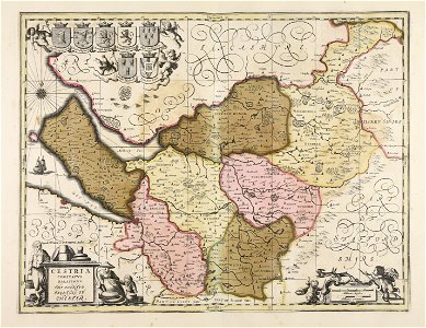
old maps of silesia
gerard valck
fonds ancely - bibliothèque municipale de toulouse - maps
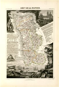
coats of arms of cities in manche
maps made in the 17th century
gerard valck
george hayward
new york city
maps of isla margarita
pictorial maps
17th-century maps of china
old maps of xinjiang
maps with cartouches
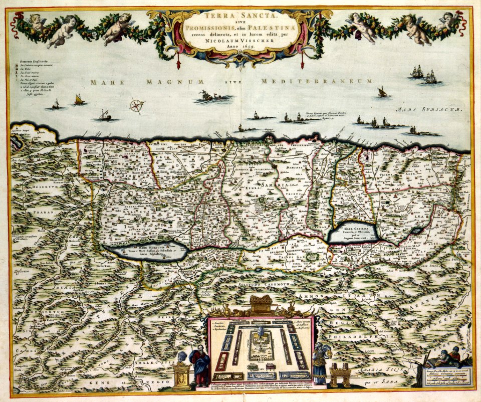
old maps of israel
jean-baptiste martenot
1888 in bretagne
jean-baptiste martenot
1888 in bretagne
maps made in the 17th century
gerard valck
maps made in the 17th century
gerard valck
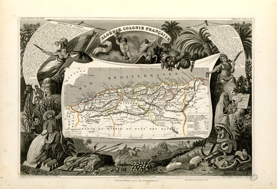
old maps of algeria
french algeria
maps made in the 17th century
gerard valck
old maps of saint petersburg governorate
atlas of the russian empire (1800)
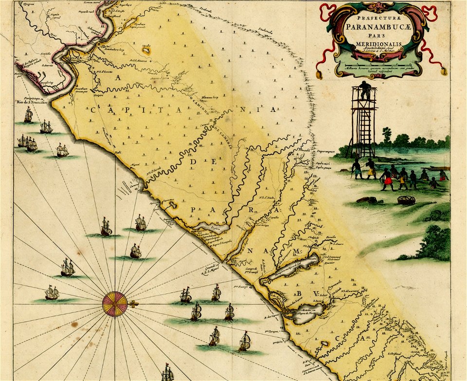
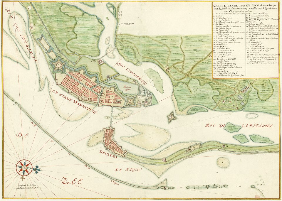
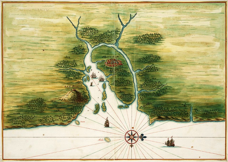
old maps of dutch brazil
1665
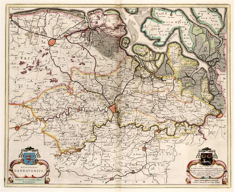
old maps of ghent
atlas van loon
geographical illustrations by coronelli
old maps of the peloponnese
german prints in the rijksmuseum amsterdam
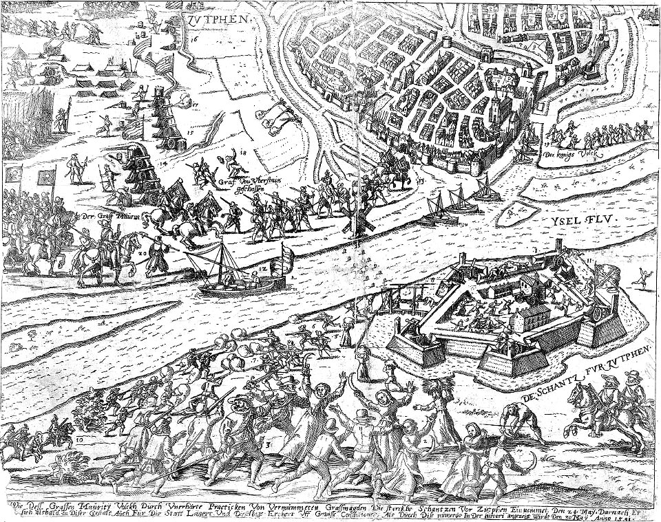
old maps of zutphen
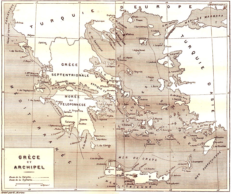
illustrations from the archipelago on fire by léon benett
old maps of greece
description des principales villes (1690)
old maps of cyprus
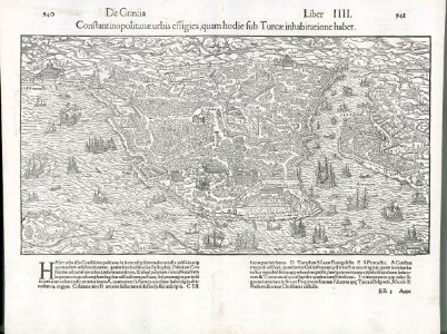
old maps of istanbul
description de l'universe
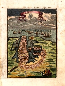
old maps of valletta
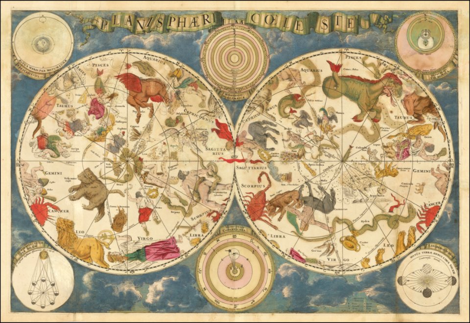
old celestial maps
frederick de wit
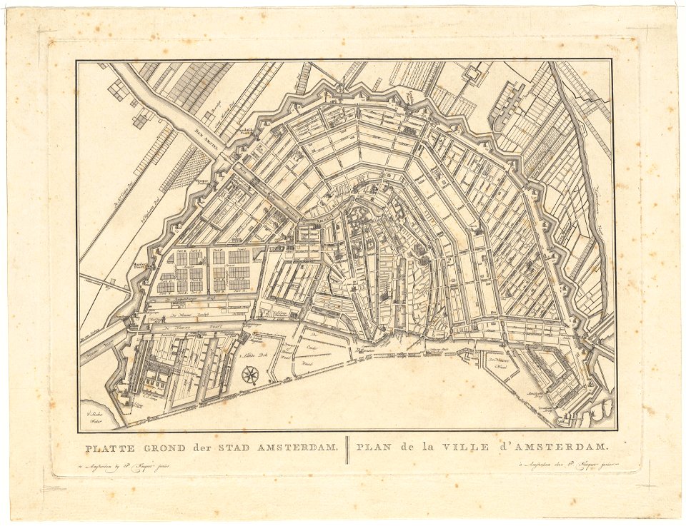
old maps of amsterdam
pierre fouquet junior
old maps of amsterdam
pierre fouquet junior
description des principales villes (1690)
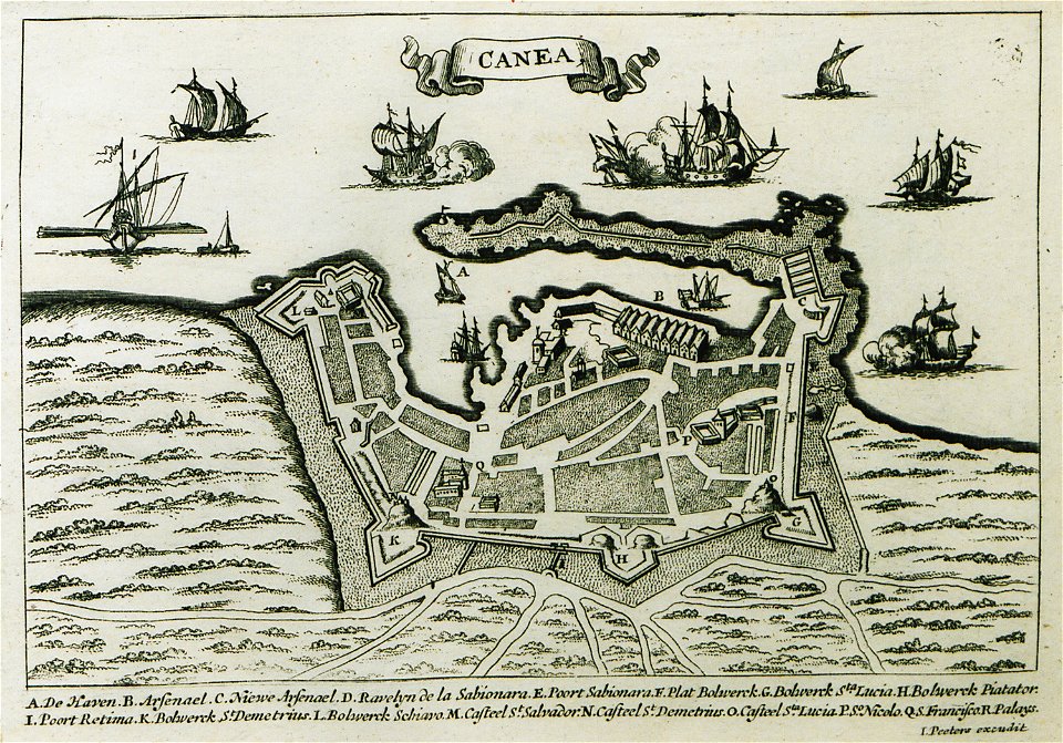
old maps of chania
geographical illustrations by coronelli
old maps of the peloponnese
geographical illustrations by coronelli
old maps of the peloponnese
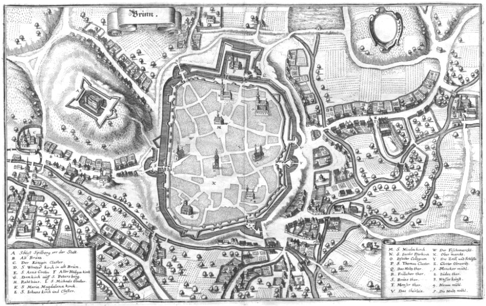
engravings of topographia bohemiae moraviae et silesiae
old maps of brno
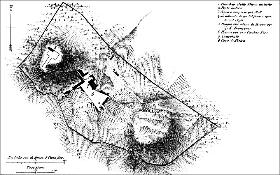
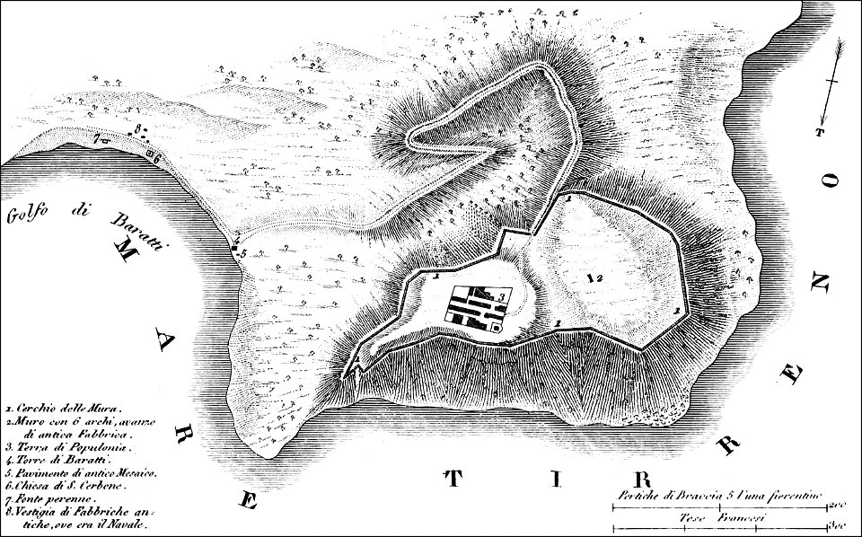
maps of archaeological sites in italy
old maps of tuscany
maps of archaeological sites in italy
old maps of tuscany
maps made in the 18th century
gerard valck
old maps of saint-omer
atlas de wit 1698
maps with cartouches
atlas van der hagen
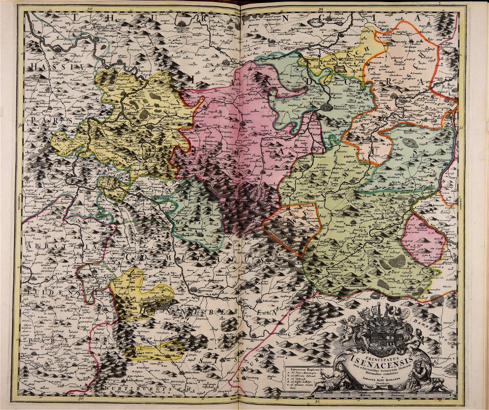
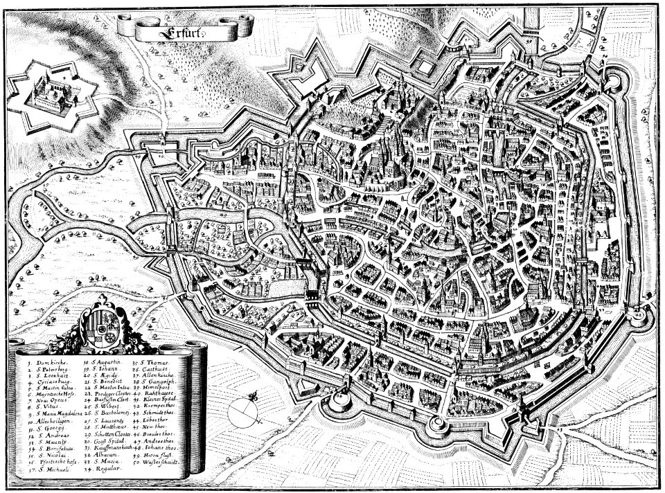
maps of erfurt
erfurt
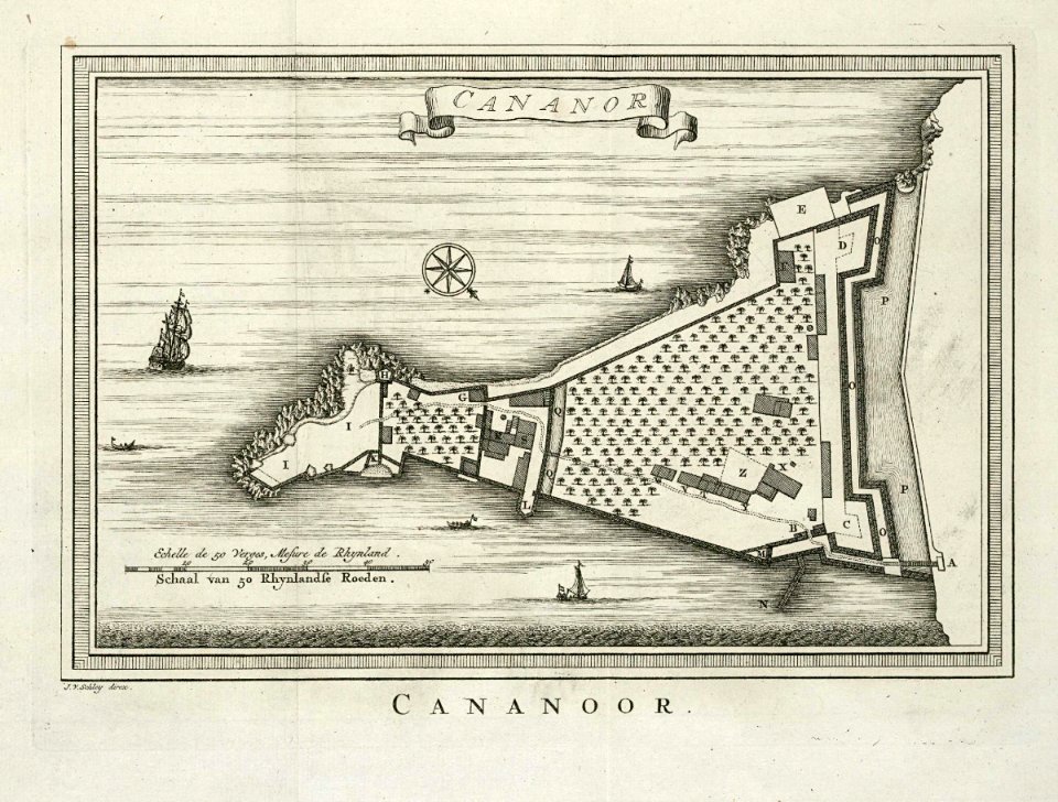
maps of the dutch east india company - india
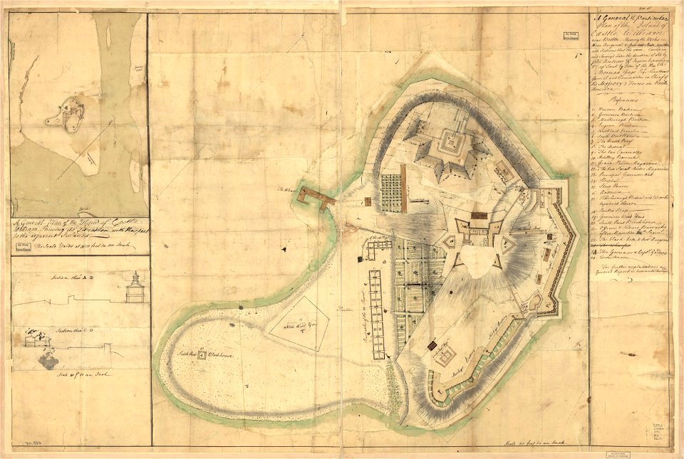
historical images of st. angelo fort
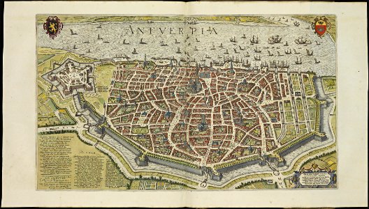
maps of antwerp city walls
frederick de wit
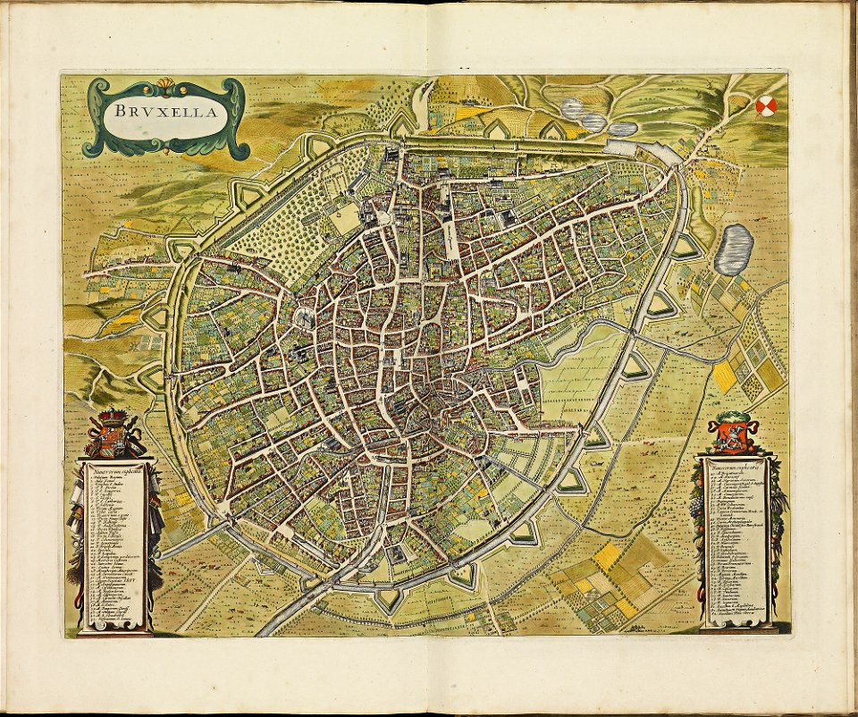
old maps of brussels
frederick de wit
maps made in the 17th century
nicolaes visscher ii
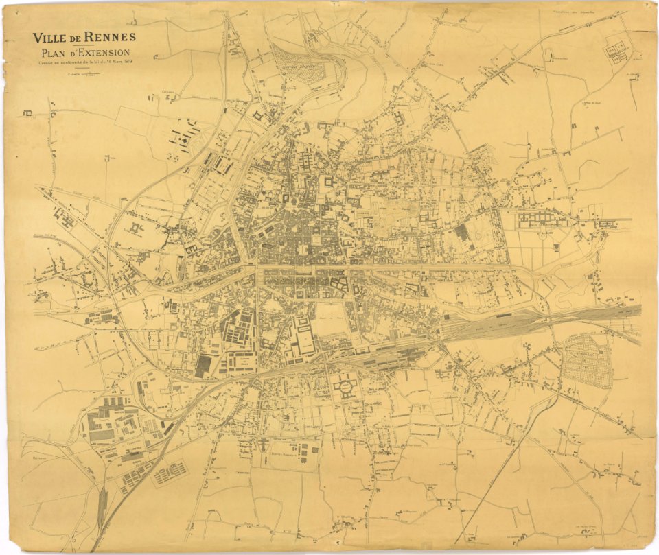
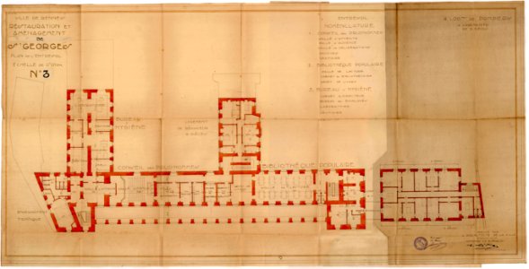
tramway de rennes
1928 in bretagne
old maps of rennes
1922 maps
jean-baptiste martenot
1885 maps
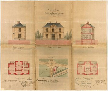
octagons (architecture)
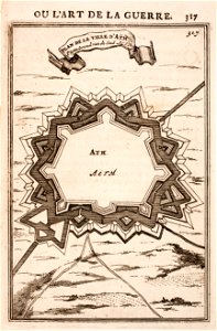
maps of ath city walls
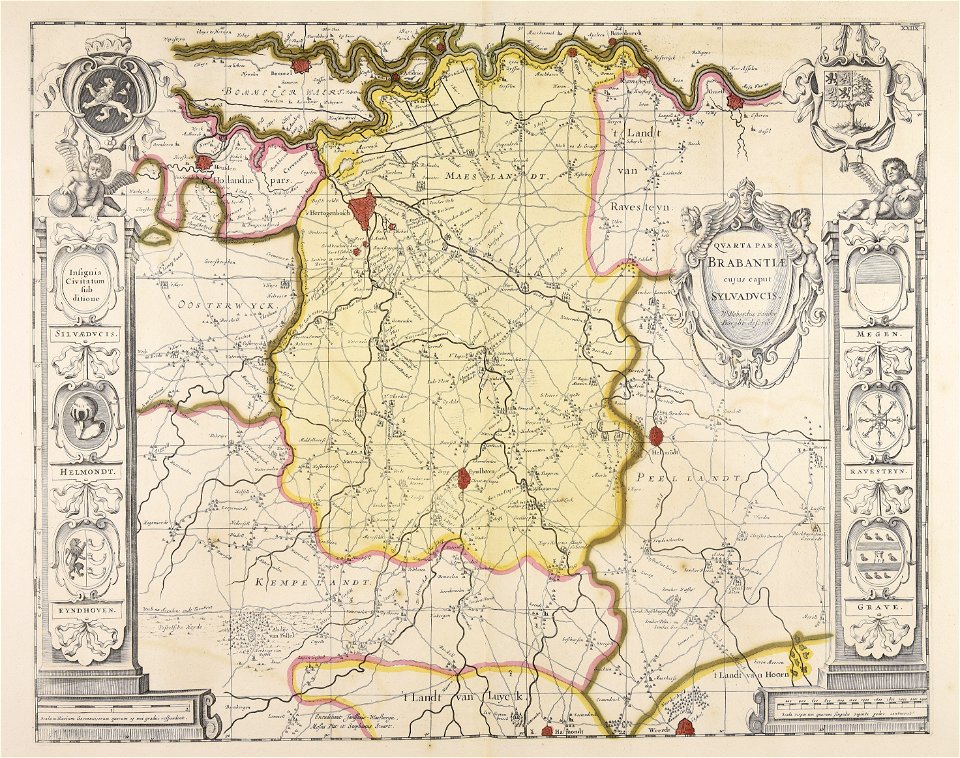
atlantis magni tomus secundus (biblioteca comunale di trento)
maps made in the 17th century
maps of the franco-dutch war
history of the french navy
images from the new york public library
new york city
university of toronto wenceslas hollar digital collection
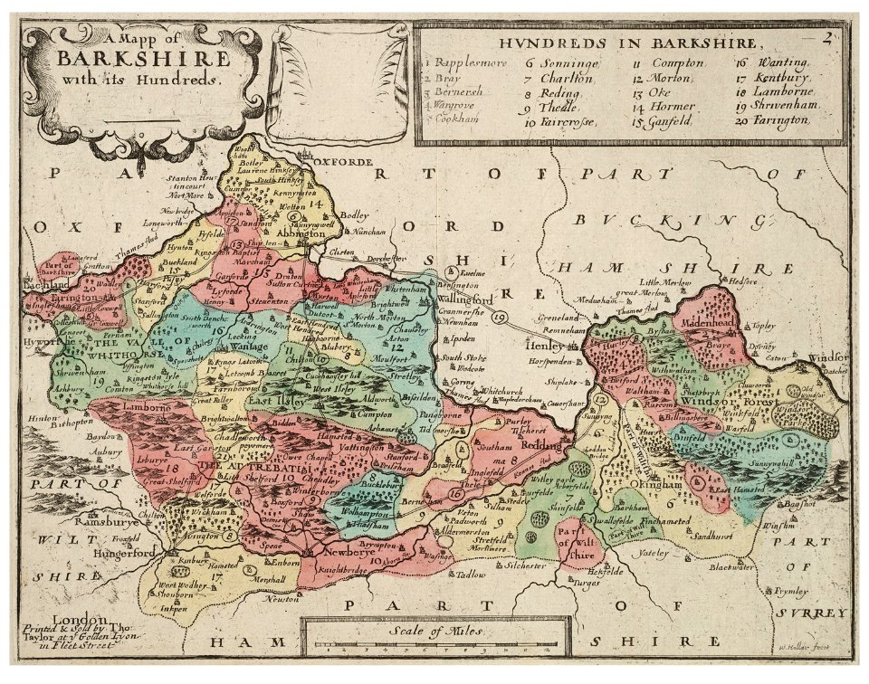
old county maps of berkshire
old maps of the peloponnese
maps by coronelli
maps from the mechanical curator collection
old maps of prussia
old map
surat
francesco piranesi
old maps of lazio
old maps of stockholm by georg biurman
ulvsunda slott - park
vienna
glacis
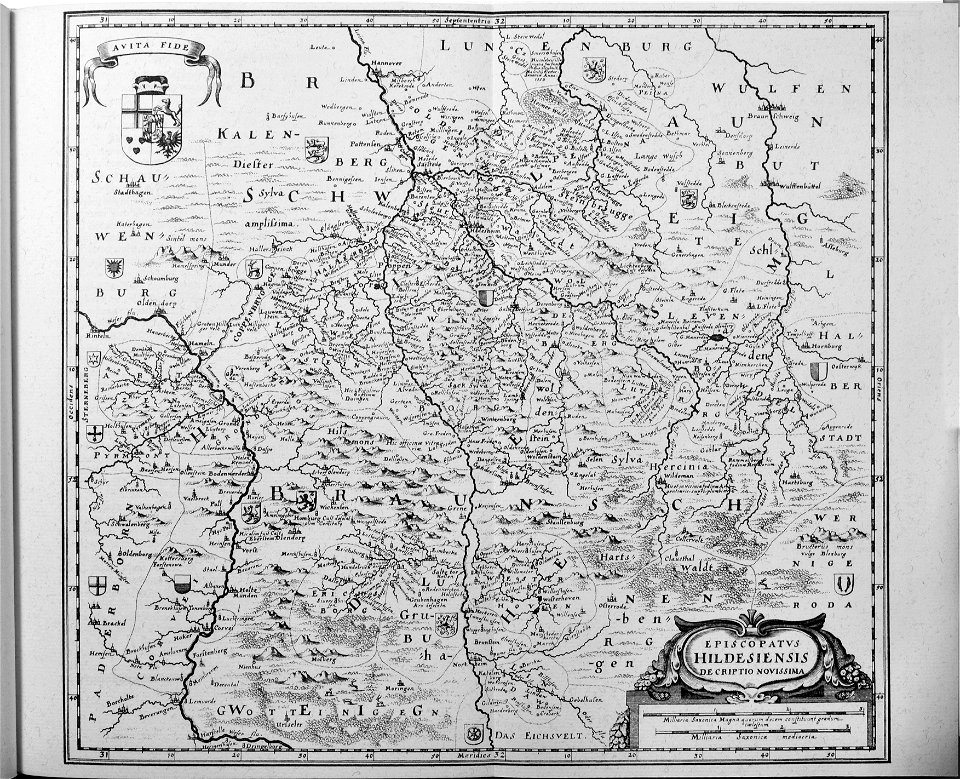
engravings of topographia saxoniae inferioris
old maps of hildesheim
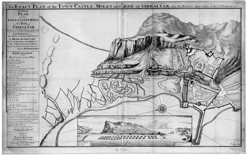
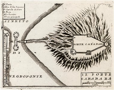
old maps of gibraltar
capture of gibraltar
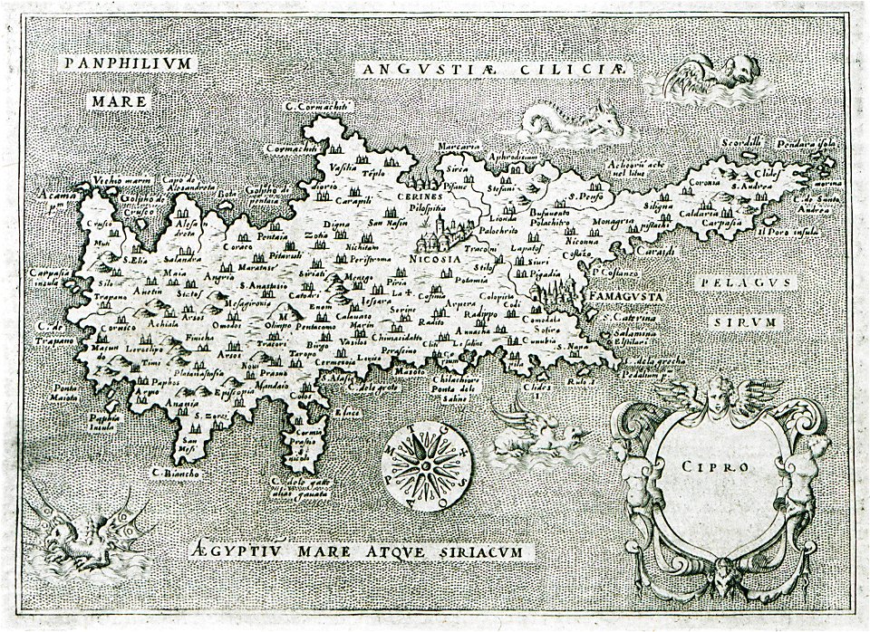
l'isole più famose del mondo
old maps of cyprus
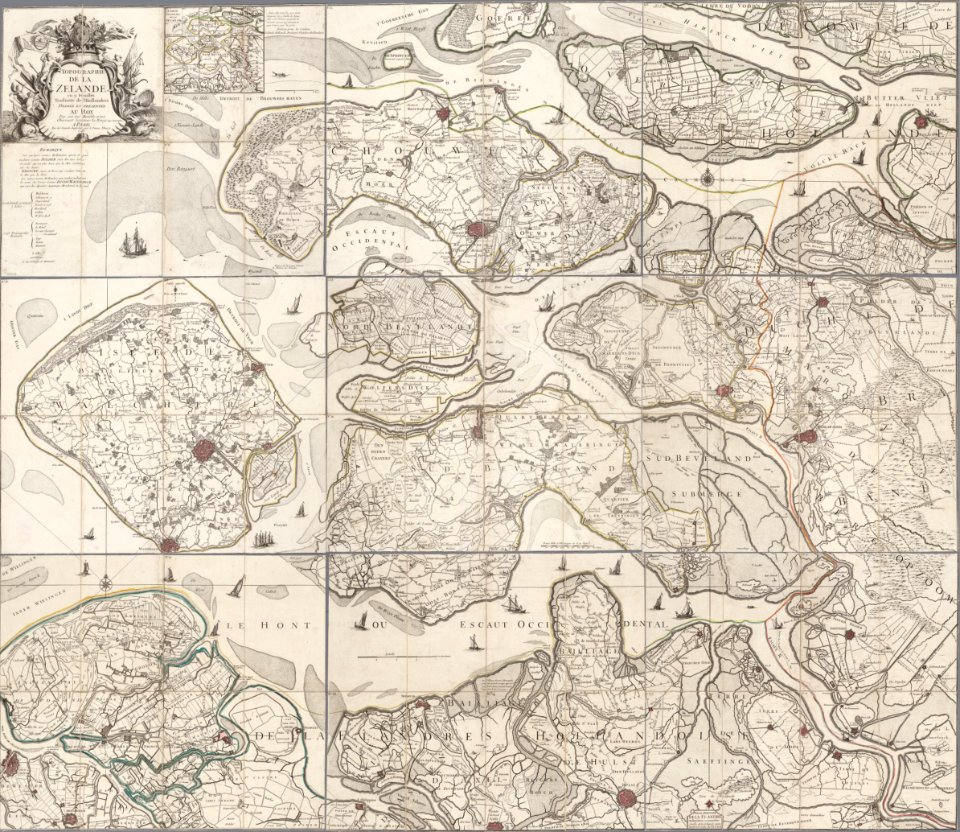
old maps of zeeland
copper engraving
old maps of saxony
elector of saxony
old maps of dutch brazil
1665
geographical illustrations by coronelli
old maps of the peloponnese
old maps of cities in sweden
landskrona
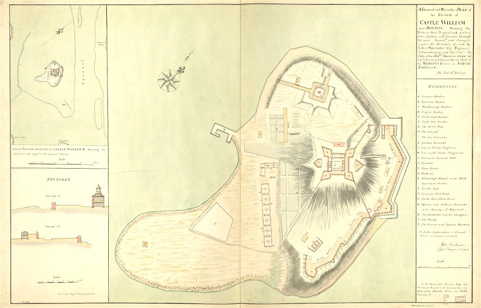
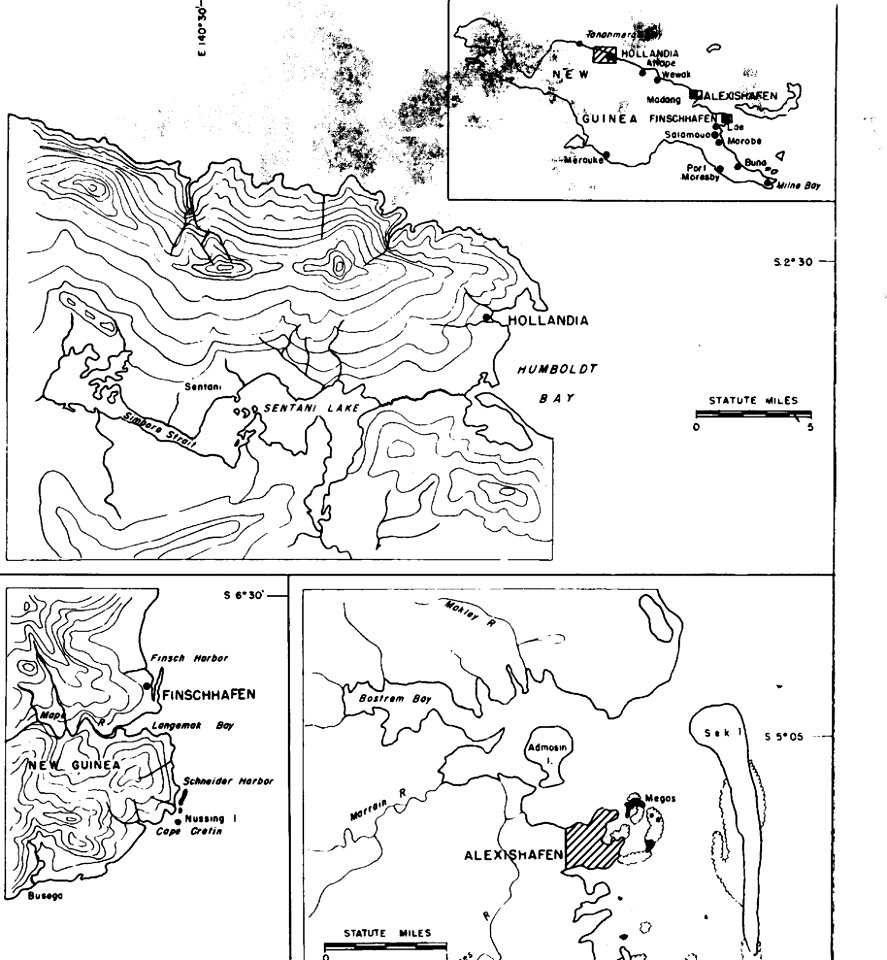
military bases of the united states
old maps of papua new guinea
old maps of amsterdam
pierre fouquet junior
old maps of greece
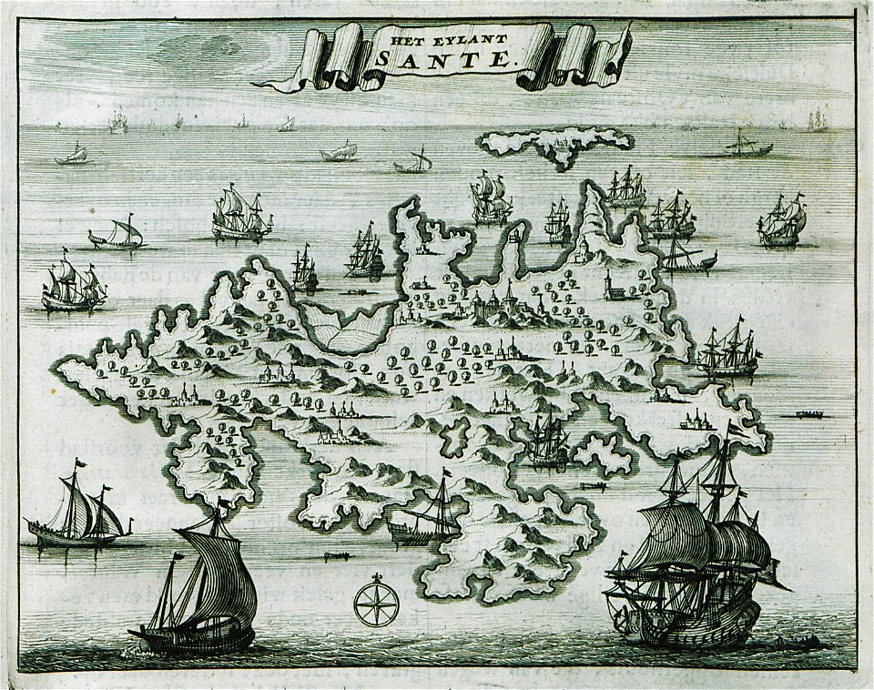
sant
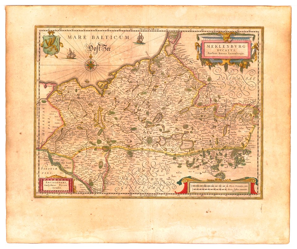
old maps of mecklenburg
atlas novus (blaeu)
fortified farms
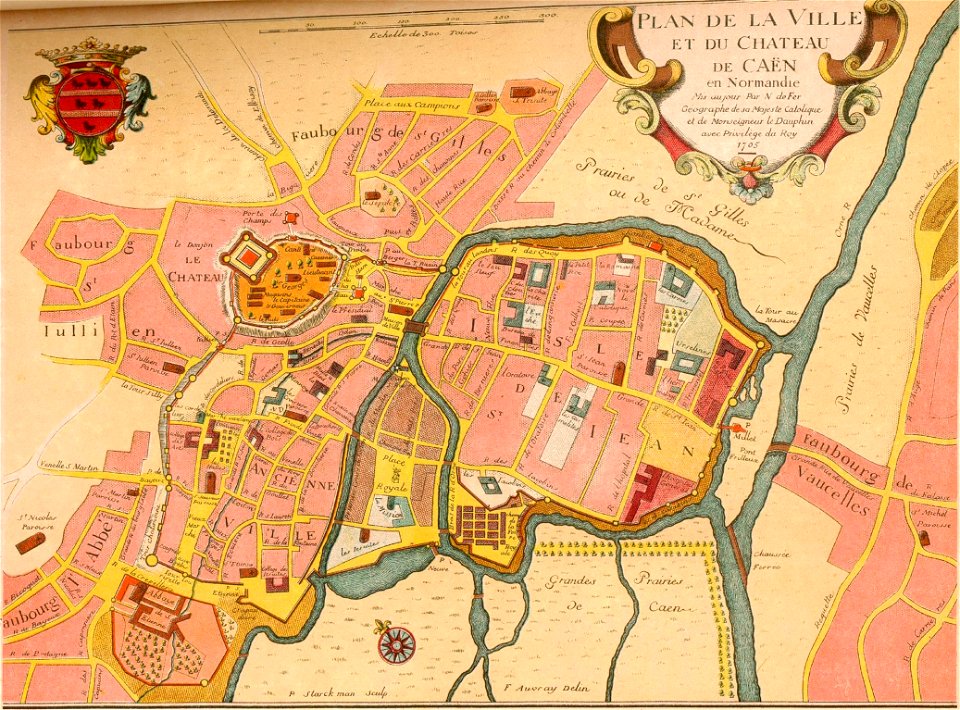
nicolas de fer
geographical illustrations by coronelli
old maps of the peloponnese
3101 - 3200 of 11,660
Next page
/ 117